Temperature
No strong signal
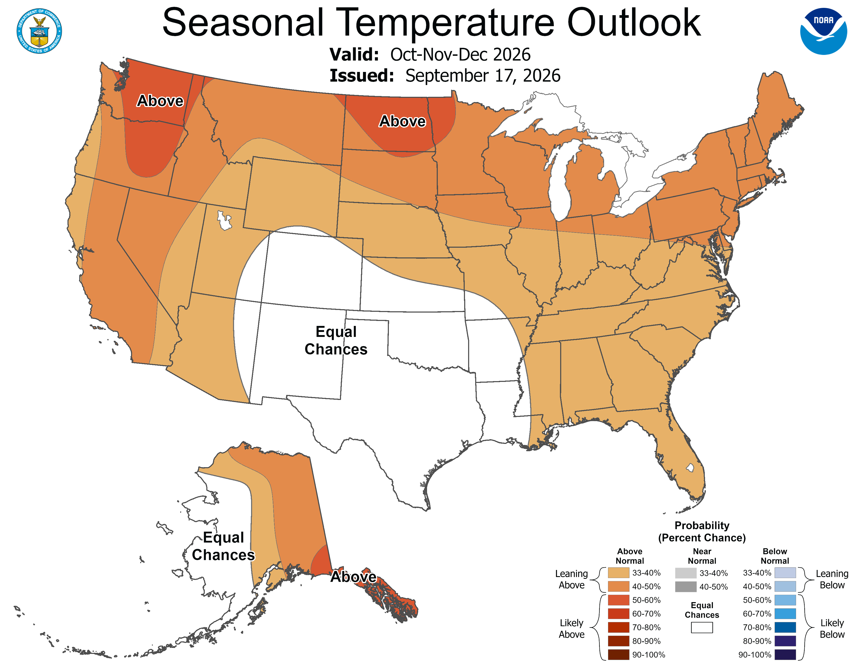
Seasonal guidance does not strongly favor an unusually warm or cold winter for the Harper area.
What kind of season should I prepare for?
NOAA's Climate Prediction Center (CPC) expects El Niño to
continue strengthening through the end of the year, with
a greater than 90% chance of a very strong event during
fall and winter 2026–27. Harper lies within the broader
southern-Plains region where this pattern generally
favors more opportunities for cool-season precipitation
as the winter storm track becomes more active across the
southern United States.
For Harper and the surrounding Hill Country, the practical
signal is a better chance of useful winter moisture than
during a typically dry winter. Temperature guidance is
less decisive, however, so this does not imply a mild
winter or protection from Arctic outbreaks, hard freezes,
ice, or short dry spells.
Seasonal guidance does not strongly favor an unusually warm or cold winter for the Harper area.
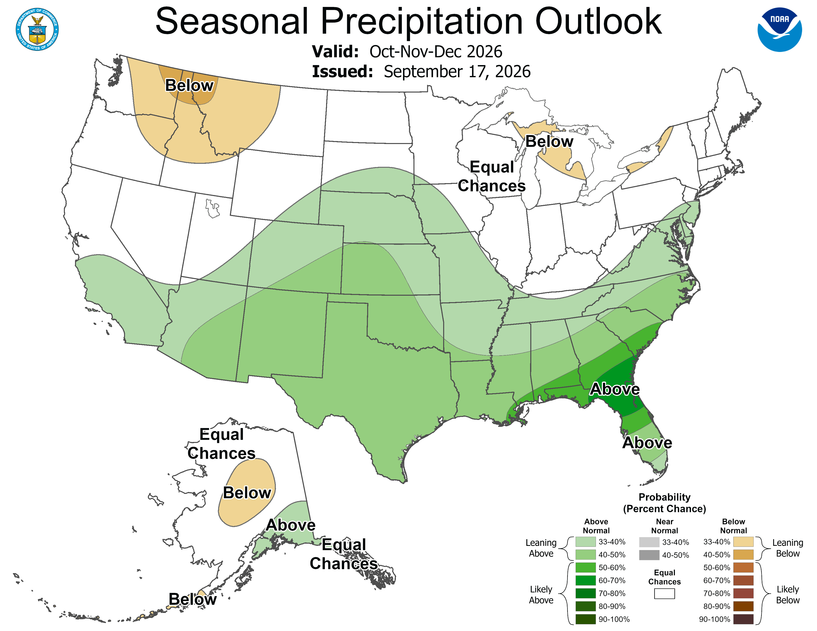
El Niño increases the odds of above-normal precipitation across parts of the southern United States.
Increased cool-season rainfall could improve drought conditions, although recovery is not guaranteed.
Seasonal outlooks cannot predict individual freezes, snow events, sleet, or ice storms months in advance.
The current large-scale pattern argues for planning around a better chance of cool-season moisture than in a typical dry winter. That could improve pasture conditions and stock-water prospects if the rainfall develops as expected. At the same time, do not relax normal freeze protection, livestock shelter, hay, feed, or water-system preparations. A seasonal outlook describes the overall pattern; it does not tell us whether Harper will experience a particular Arctic outbreak, hard freeze, snowstorm, or ice event.
Probability outlook comparing the coming three-month period with the historical climate record.
View CPC temperature outlook →Probability outlook for above-normal, near-normal, or below-normal precipitation.
View CPC precipitation outlook →CPC assessment of where drought is expected to persist, improve, develop, or end.
View CPC drought outlook →ENSO is one of the strongest large-scale influences on southern U.S. winter weather patterns.
View CPC ENSO information →CPC gives a greater than 90% chance of a very strong El Niño during fall and winter 2026–27.
For October–December 2026, CPC assigns a 75% chance that this event exceeds the strength of previous El Niño events in the modern record.
During the strongest part of the winter signal, CPC places the southern Plains in roughly the 40–50% probability range for above-normal precipitation.
A strong El Niño favors a more active southern storm track, increasing opportunities for cool-season precipitation across Texas and the southern United States.
Ocean and atmosphere indicators are strongly coupled and consistent with a strengthening El Niño. CPC is watching the magnitude of the event, the persistence of the Pacific circulation pattern, and whether newer model guidance supports increasing or decreasing the winter precipitation probabilities.
No reviewed change has been detected since the current Harper interpretation was prepared.